Traci Atkins Vision Plan
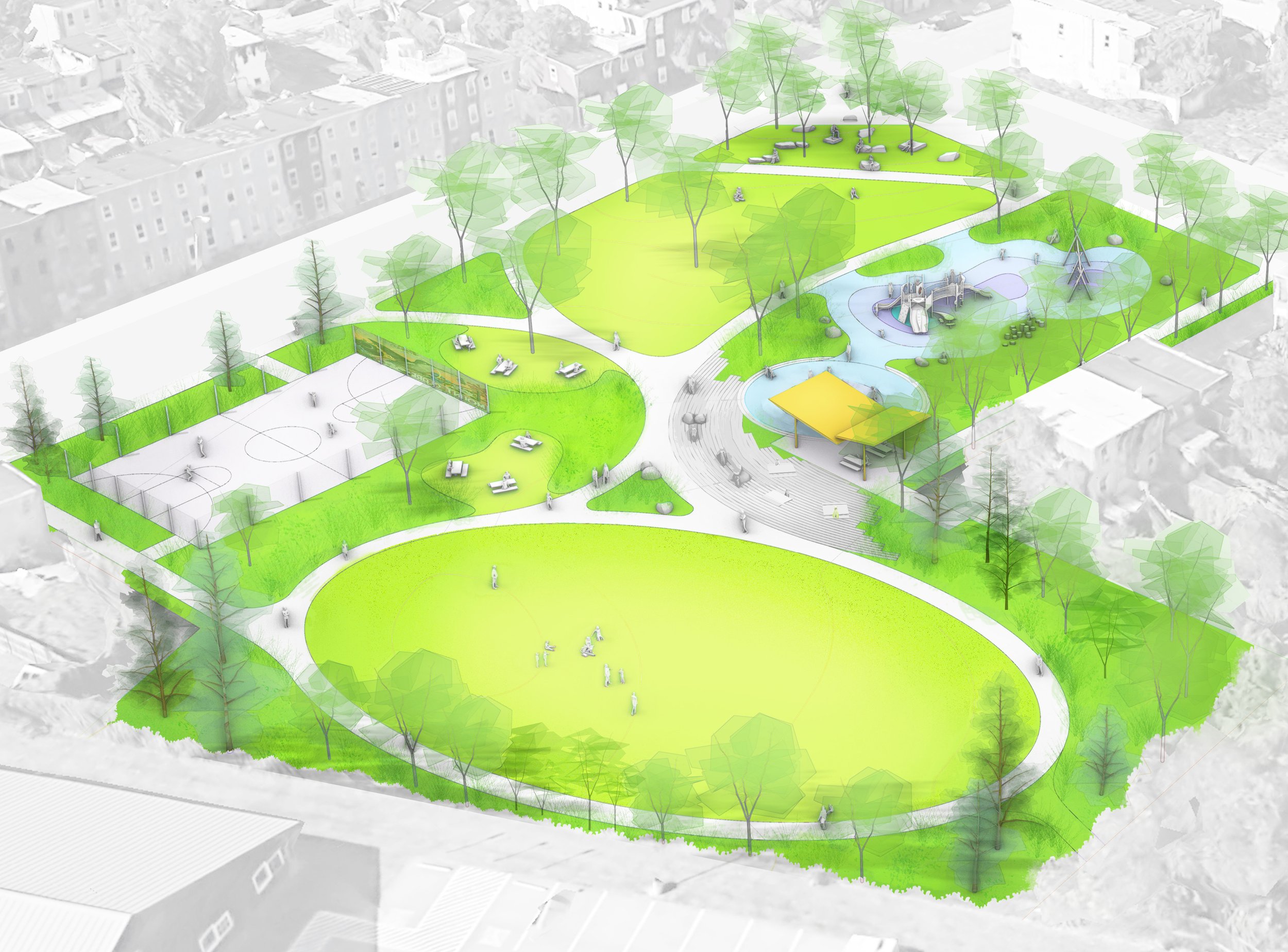
THE VISION PLAN provides an actionable framework for the phased revitalization of Traci Atkins Park. It calls for the surgical removal of some of the original park infrastructure, the greening of large areas of paving and the addition of higher-value amenities and gathering spaces within the frame of an immersively planted tiny forest.
From the standpoint of urban design, the Vision Plan grounds Traci Atkins Park within the fabric of Baltimore City’s open space network. This is a small pocket park that serves the surrounding neighborhood. However, it sits adjacent to the much larger regional destination of Carroll Park, a 117 acre open space just to the south, but remains physically cut off from it by a spur of the Baltimore & Ohio railroad. Both Carroll Park and the land area of Traci Atkins Park were historically part of the Carroll family’s 18th-century estate, Mount Clare. In the early twentieth century, Carroll Park was incorporated into Baltimore’s public park system as an anchor, together with Druid Hill Park and Patterson Park (all of which feature prominently in the Olmsted Brothers’ 1904 master plan for Baltimore).
On a neighborhood level, Traci Atkins plays a similar role to West Baltimore’s three historic “green square” parks, just to the north: Harlem Square Park, Franklin Square Park, and Union Square Park. But, whereas these three spaces were designed in tandem with the city’s expanding street infrastructure and neighborhood fabric, Traci Atkins was retrofitted opportunistically and is somewhat hindered in its ability to serve the surrounding community by virtue of the B&O railroad just to the south. In addition to reimagining the character of the park with a diverse array of spaces, the Vision Plan reimagines the park with an expanded role in the city. As the plan moves forward, Traci Atkins will pivot from tucked-away-pocket-park to recreational gateway connecting the community of Mount Clare with a city-wide network of green spaces.
2024 MARYLAND ASLA MERIT AWARD